
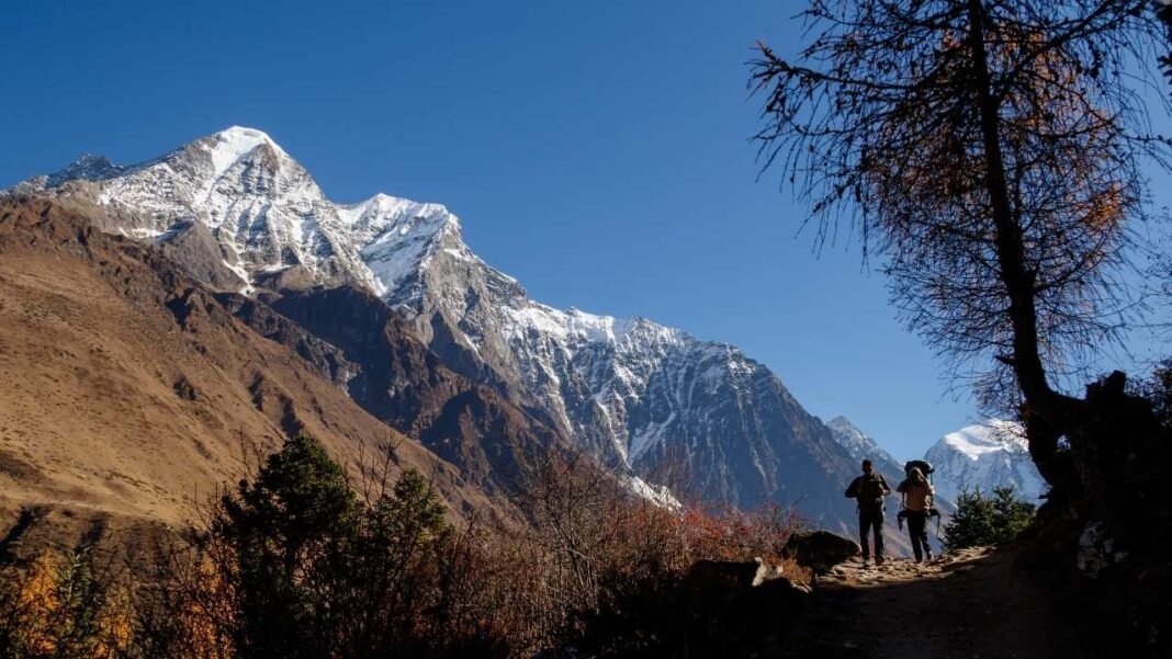

Planning the Manaslu Circuit Trek starts with understanding the route not just the itinerary. Located in Nepal’s remote Gorkha District, the Manaslu Circuit winds around Mount Manaslu (8,163 m / 26,781 ft), the world’s eighth-highest mountain, before crossing the spectacular Larke Pass (5,106 m / 16,752 ft) and descending into the Annapurna region. Unlike more commercial trekking routes, this trail passes through isolated mountain villages, deep river gorges, dense forests, and high alpine landscapes where knowing the route can make your journey much smoother.
A good Manaslu Circuit trek map does more than show you where to walk. It helps you understand daily distances, elevation gain, acclimatization stops, key villages, side trips, and where the trail becomes most challenging. Whether you are trekking with a licensed guide as required by current regulations or simply planning your adventure from home, a detailed map gives you a much clearer picture of what to expect each day.
This article walks you through the entire Manaslu Circuit route, showing where each village, landmark, and major climb fits into the journey. You will also find practical distance and elevation data, along with offline navigation tools that make planning much easier.
Manaslu Circuit Trek Map at a Glance
Before diving into the route, it is helpful to understand the big picture. The Manaslu Circuit is a point-to-point trek that begins in the lower Budhi Gandaki Valley, gradually climbs into the high Himalayas, crosses Larke Pass, and finishes in the Annapurna region. Unlike Everest Base Camp, you do not retrace your steps, so every day brings new scenery.
| Detail | Information |
| Region | Gorkha District, Nepal |
| Starting Point | Machha Khola (930m/ 3,051ft) |
| Ending Point | Dharapani (1,860m/ 6,102ft) |
| Highest Point | Larke Pass (5,106m/ 16,752ft) |
| Total Trek Distance | Approx. 175–190 km (109–118 miles) |
| Typical Duration | 13–17 days |
| Difficulty | Moderate to Challenging |
| Trek Type | Point-to-Point |
Where Is the Manaslu Circuit Located?
The Manaslu Circuit lies in northwestern Nepal, within the remote mountains of Gorkha District. The trail circles Mount Manaslu (8,163 m / 26,781 ft), the world’s eighth-highest mountain, before crossing Larke Pass and descending into the Annapurna region.
Most of the trek takes place inside the Manaslu Conservation Area, a protected landscape known for its rich biodiversity, traditional Tibetan-influenced villages, and dramatic Himalayan scenery. After crossing Larke Pass, the trail enters the Annapurna Conservation Area, where it joins the well-known Annapurna Circuit near Dharapani.
One reason the route feels so diverse is that it passes through several climate zones. You begin in warm river valleys, walk through dense forests and terraced hillsides, reach alpine meadows and glacial terrain above 5,000 meters, then descend into lush pine forests on the Annapurna side. Looking at the route on a map makes this transition much easier to understand before you arrive.
Complete Manaslu Circuit Route Explained
One of the reasons the Manaslu Circuit is considered one of Nepal’s best long-distance treks is the way the landscape changes from start to finish. Rather than heading to a single destination and returning the same way, you gradually travel from subtropical river valleys to the high Himalayas before descending into a completely different valley. Every few days, the scenery, climate, and local culture noticeably change.
The journey begins in Kathmandu, where most trekkers complete their permit formalities before taking a long drive to Machha Khola. This small riverside village marks the start of the trek.
From Machha Khola, the trail follows the Budhi Gandaki River, which is the backbone of the Manaslu Circuit for much of the journey. During the first several days, you will repeatedly cross the river on suspension bridges while climbing gradually through terraced farmland, waterfalls, forests, and traditional Gurung villages.
Your first major stop is Jagat, the official gateway to the restricted Manaslu region. Beyond this point, the trail becomes quieter as you enter a more remote section of the Himalayas with fewer settlements and significantly fewer trekkers than on Everest or Annapurna.
Continuing north, you will pass through Deng and Namrung, where the scenery begins to change. Dense forests gradually give way to open mountain views, and you will start noticing stronger Tibetan cultural influences in the architecture, monasteries, and prayer walls.
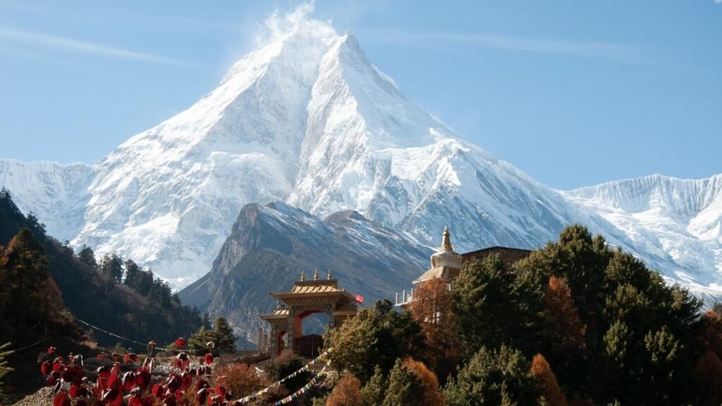
The route then climbs to Lho, one of the trek’s most scenic villages. From here, Mount Manaslu dominates the skyline, and many trekkers get their first uninterrupted views of the mountain.
Beyond Lho lies Samagaon, the largest village on the circuit and one of the most important acclimatization stops. Most itineraries include a rest day here because the altitude increases significantly from this point onward. It is also the base for popular side trips such as Birendra Lake, Pungen Gompa, and Manaslu Base Camp.
After Samagaon, the trail becomes more rugged as you head to Samdo, the last permanent village before the pass. Vegetation becomes sparse, the valley widens, and the surrounding peaks feel much closer.
The final overnight stop before crossing the pass is Dharamsala (Larke Phedi). Although often called a village, it is really a small collection of seasonal lodges used as a staging point for the early morning ascent to Larke Pass.
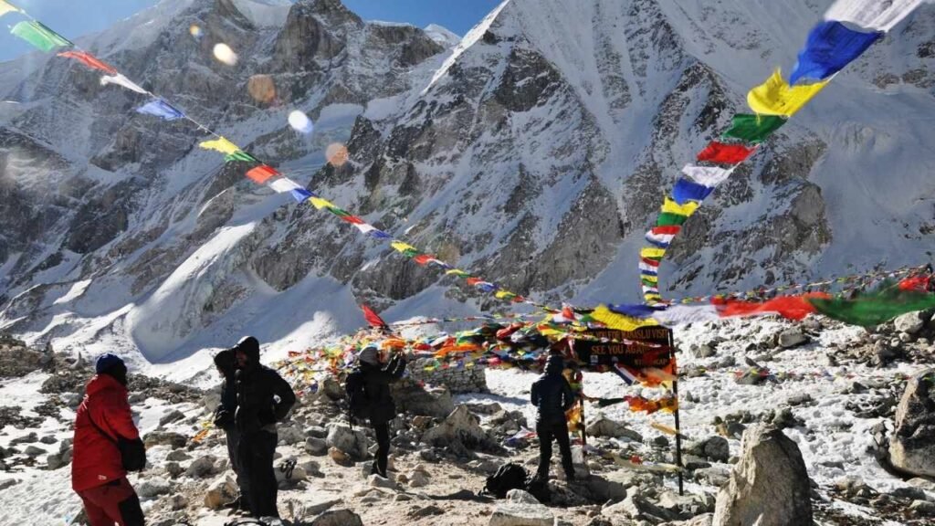
Crossing Larke Pass (5,106 m / 16,752 ft) is the highlight of the trek. The climb begins before sunrise and rewards you with panoramic views of Himlung Himal, Cheo Himal, Kang Guru, Annapurna II, and countless snow-covered peaks stretching across the horizon.
After the pass, the character of the trek changes once again. A long descent leads to Bimthang, where forests, alpine meadows, and glacial streams replace the rocky high-altitude terrain.
The final walking days continue through Tilije before reaching Dharapani, where the Manaslu Circuit officially ends and connects with the famous Annapurna Circuit.
The route follows the Budhi Gandaki River for nearly the entire ascent because the river has carved one of the few natural corridors through this rugged mountain range. Instead of climbing directly over steep ridges, the trail gradually gains elevation by following the valley upstream. After crossing Larke Pass, the watershed changes completely. From that point onward, the trail descends into the Marsyangdi Valley, marking the transition from the Manaslu region into the Annapurna Conservation Area.
Day-by-Day Route Map
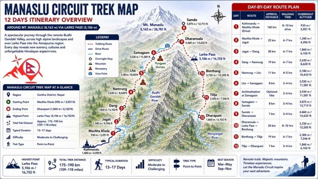
Although every itinerary is slightly different, the route follows the same geographical progression. The first half of the trek focuses on gaining elevation gradually along the Budhi Gandaki Valley, while the second half crosses Larke Pass before descending through the Marsyangdi Valley.
| Day | Route | Approx. Distance | Walking Time | Overnight Altitude |
| 1 | Kathmandu → Machha Khola (Drive) | 160 km | 8–10 hrs drive | 930 m |
| 2 | Machha Khola → Jagat | 22 km | 6–7 hrs | 1,340 m |
| 3 | Jagat → Deng | 20 km | 6–7 hrs | 1,860 m |
| 4 | Deng → Namrung | 19 km | 6–7 hrs | 2,630 m |
| 5 | Namrung → Lho | 11 km | 4–5 hrs | 3,180 m |
| 6 | Lho → Samagaon | 8 km | 3–4 hrs | 3,530 m |
| 7 | Acclimatization at Samagaon | Optional hike | 3–6 hrs | 3,530 m |
| 8 | Samagaon → Samdo | 8 km | 3–4 hrs | 3,875 m |
| 9 | Samdo → Dharamsala | 7 km | 3–4 hrs | 4,460 m |
| 10 | Dharamsala → Larke Pass → Bimthang | 24 km | 8–10 hrs | 3,720 m |
| 11 | Bimthang → Tilije | 19 km | 6–7 hrs | 2,300 m |
| 12 | Tilije → Dharapani | 7 km | 3–4 hrs | 1,860 m |
Looking at the map, you can clearly see that the trek is divided into three distinct phases. The first phase follows the Budhi Gandaki Valley through forests and villages. The second climbs above the tree line toward Samagaon, Samdo, and Larke Pass, where altitude becomes the main challenge. The final phase is almost entirely downhill as the trail enters the greener Marsyangdi Valley before finishing at Dharapani.
Elevation Map of the Manaslu Circuit
The Manaslu Circuit is designed to gain altitude gradually, which is one of the reasons it has a relatively high success rate despite crossing a pass above 5,000 meters. Rather than making steep jumps in elevation, the trail spreads the ascent over several days, giving your body time to adjust.
The most important acclimatization stop is Samagaon (3,530 m). Spending an extra day here is not just a recommendation it is considered an essential part of a safe itinerary. Most trekkers use the day to hike to a higher elevation, such as Birendra Lake or Pungen Gompa, before returning to sleep in Samagaon. This “climb high, sleep low” approach helps your body adapt before moving higher.
Your highest overnight stay is usually Dharamsala (4,460 m), the final stop before Larke Pass. Sleeping here allows for an early start the next morning, when snow conditions and weather are generally more stable.
The crossing of Larke Pass (5,106 m) is the highest point of the trek, but you only spend a short time at this elevation before descending more than 1,300 meters to Bimthang. That rapid descent is another reason the itinerary works well from an acclimatization standpoint you climb high during the day but sleep much lower afterward.
| Location | Elevation |
| Machha Khola | 930 m |
| Jagat | 1,340 m |
| Deng | 1,860 m |
| Namrung | 2,630 m |
| Lho | 3,180 m |
| Samagaon | 3,530 m |
| Samdo | 3,875 m |
| Dharamsala | 4,460 m |
| Larke Pass | 5,106 m |
| Bimthang | 3,720 m |
| Tilije | 2,300 m |
| Dharapani | 1,860 m |
The elevation profile also explains why the Manaslu Circuit feels progressively harder. The daily distances do not increase dramatically, but the thinner air means you will naturally walk more slowly with each passing day. By the time you reach Dharamsala, the challenge is no longer the trail itself it is the altitude.
Understanding that progression on a map helps set realistic expectations and reinforces why following a proper acclimatization schedule is far more important than trying to complete the trek as quickly as possible.
Total Distance of the Manaslu Circuit Trek
One of the first things you will notice when researching the Manaslu Circuit is that no two websites seem to agree on the total distance. Some say 170 km (106 miles), others quote 177 km (110 miles), while some estimate 190 km (118 miles) or even more. So, which one is correct? The short answer is that they are all reasonable estimates. The exact distance depends on how it is measured, the itinerary you follow, and whether you include side trips or the drive to and from the trailhead.
Why Do Different Websites Show Different Distances?
There is not an official “race course” for the Manaslu Circuit. Trekking trails are measured in different ways, which naturally leads to different totals. For example, GPS devices record every bend in the trail, while older trekking maps often round distances between villages. Some websites also include short detours through villages or lodge areas, whereas others measure only the main trail.
Another factor is that road construction has gradually pushed the traditional starting point farther north. Years ago, many trekkers began walking from Soti Khola, but today most itineraries start from Machha Khola, reducing the total trekking distance slightly.
GPS Distance vs. Trekking Signs
Do not be surprised if your GPS watch shows a different distance from the trail signs.
GPS devices calculate the actual path you walk, including every switchback, bridge crossing, and small detour. Trekking signs, on the other hand, usually provide approximate distances or estimated walking times rather than precise GPS measurements.
In the mountains, hiking time is often a better planning tool than distance alone. A 10 km section with a steep climb can take much longer than a relatively flat 15 km stretch.
Side Trips Can Add 10–30 km
Most trekkers do not simply walk from Machha Khola to Dharapani. The Manaslu Circuit has several worthwhile side trips that can significantly increase your total distance.
Popular additions include:
- Birendra Lake
- Pungen Gompa
- Manaslu Base Camp
- Samdo Ridge or Tibet Viewpoint
If you visit one or more of these destinations during your acclimatization days, your total trekking distance can easily increase by 10–30 km (6–19 miles), depending on the hikes you choose.
How Far Will You Walk Each Day?
Although the total distance is around 175–190 km (109–118 miles), you won’t be covering the same mileage every day. The early stages feature longer walks through lower valleys, while the higher sections become shorter as the altitude increases.
The crossing of Larke Pass is usually the longest and most demanding day, combining both distance and elevation gain. As a general guide, most trekkers can expect to walk:
| Section | Typical Daily Distance |
| Lower Budhi Gandaki Valley | 18–22 km (11–14 miles) |
| Mid-Elevation Villages | 10–18 km (6–11 miles) |
| High-Altitude Section | 7–12 km (4–7 miles) |
| Larke Pass Day | 20–24 km (12–15 miles) |
| Overall Average | 14–17 km (9–11 miles) per day |
Major Villages Along the Manaslu Circuit Route
One of the easiest ways to understand the Manaslu Circuit map is to look at the villages along the trail. Each stop marks a noticeable change in altitude, landscape, and culture. The lower villages are surrounded by lush forests and terraced farmland, while the upper settlements become increasingly Tibetan in character as you approach the high Himalayas.
Here is what each major village offers and why it matters during the trek.
| Village | Why It Matters | Accommodation | Highlights |
| Machha Khola | Trek starting point | Teahouses | Budhi Gandaki River, hot springs nearby |
| Jagat | Entry to the restricted area | Teahouses | Stone-paved streets, traditional village |
| Deng | Transition into Tibetan-influenced region | Teahouses | Forests, river crossings, mani walls |
| Namrung | First major mountain views | Comfortable teahouses | Views of Himal Chuli and Ganesh Himal |
| Lho | One of the most scenic villages | Teahouses | Ribung Monastery, Mount Manaslu views |
| Samagaon | Main acclimatization stop | Best selection of lodges | Birendra Lake, Manaslu Base Camp access |
| Samdo | Last permanent village | Teahouses | Tibetan culture, acclimatization hikes |
| Dharamsala | Final stop before Larke Pass | Basic lodges | High-altitude staging point |
| Bimthang | First village after Larke Pass | Comfortable teahouses | Glacier views, alpine meadows |
| Dharapani | Official end of the trek | Lodges, guesthouses | Connection to the Annapurna Circuit |
Machha Khola (930 m)
Machha Khola is where the trekking portion of the Manaslu Circuit begins for most people. After the long drive from Kathmandu, this small riverside village offers a chance to settle into the rhythm of the trek before heading into the mountains. Accommodation is simple but comfortable, with several teahouses providing private rooms and hot meals. The Budhi Gandaki River flows alongside the village, and nearby natural hot springs are a popular stop for trekkers who arrive early enough to visit.
Jagat (1,340 m)
Jagat is much more than just another overnight stop. It is the official gateway to the Manaslu Restricted Area, where trekking permits are checked before you continue farther north. The village stands out for its stone-paved alleys, traditional houses, and well-preserved character. From here onward, the trail becomes noticeably quieter, and you will begin to appreciate why the Manaslu Circuit feels more remote than Nepal’s busier trekking routes.
Deng (1,860 m)
By the time you reach Deng, you will notice the landscape beginning to change. Dense subtropical vegetation gradually gives way to cooler forests, while Buddhist influences become more visible through mani walls, chortens, and prayer flags. Although Deng is a relatively small village, it is an important milestone because it marks your transition into the upper Budhi Gandaki Valley, where Tibetan culture becomes increasingly prominent.
Namrung (2,630 m)
Namrung is often remembered as the place where the Himalayan scenery truly opens up. After several days of walking through narrow valleys, the surrounding peaks begin to dominate the horizon. The village has some of the better teahouses on the lower half of the trek, making it a comfortable overnight stop. On clear days, you will enjoy excellent views of Ganesh Himal, Himal Chuli, and other surrounding peaks before continuing toward Manaslu itself.
Lho (3,180 m)
Lho is one of the highlights of the Manaslu Circuit. Sitting on a hillside directly beneath Mount Manaslu, it offers some of the trek’s first truly spectacular mountain panoramas. The village is also home to Ribung Monastery, one of the oldest monasteries in the region. Many trekkers spend time exploring the monastery or simply enjoying sunrise and sunset views over the snow-covered summit of Manaslu.
Samagaon (3,530 m)
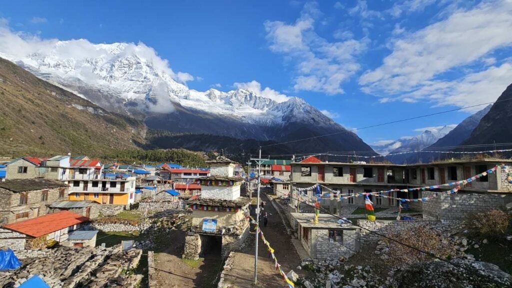
Samagaon is the largest settlement on the Manaslu Circuit and one of the most important stops on the entire trek. Nearly every itinerary includes an acclimatization day here, giving your body time to adjust before heading to higher elevations. The village also serves as the base for several of the circuit’s best side trips, including Birendra Lake, Pungen Gompa, and Manaslu Base Camp. Because many trekkers spend two nights here, you will generally find the widest selection of lodges, bakeries, cafés, and small shops anywhere on the route.
Samdo (3,875 m)
Just a few hours beyond Samagaon lies Samdo, the last permanent village before Larke Pass. The environment becomes noticeably harsher, with fewer trees, wider valleys, and stronger mountain winds. Samdo has a distinctly Tibetan atmosphere, and many local families have ancestral ties to communities across the nearby border. It is also a popular place for short acclimatization hikes to nearby ridges, where you will gain impressive views of the surrounding mountains before descending to sleep.
Dharamsala (4,460 m)
Despite often appearing on maps as a village, Dharamsala is really a small seasonal settlement built to support trekkers crossing Larke Pass. Accommodation here is basic compared with lower villages, with simple lodges offering shared dining rooms and limited facilities. Most trekkers arrive by early afternoon, rest, and prepare for an early morning departure, as the pass is safest to cross before weather conditions deteriorate later in the day.
Bimthang (3,720 m)
After the demanding crossing of Larke Pass, Bimthang feels like a reward. The village sits in a broad alpine valley surrounded by glaciers, meadows, and towering Himalayan peaks. Many trekkers consider this one of the most beautiful overnight stops on the circuit. The descent from the pass also brings noticeably warmer temperatures and a welcome increase in oxygen, making it one of the most relaxing evenings of the trek.
Dharapani (1,860 m)
Dharapani marks the official end of the Manaslu Circuit. Located in the Marsyangdi Valley, it is where the trail joins the famous Annapurna Circuit. Compared with the remote villages you have passed over the previous days, Dharapani feels much busier. It offers comfortable lodges, road access, and regular jeep connections, making it the natural point to conclude the trek or continue toward other destinations in the Annapurna region.
Together, these villages tell the story of the Manaslu Circuit. As you move from one to the next, you are not just gaining altitude you are passing through different ecosystems, cultures, and landscapes, which is one of the reasons this trek is often regarded as one of Nepal’s most rewarding long-distance adventures.