
 by road, depending on the route and exact points)
The distance from Pokhara to Jomsom is approximately 150 to 160 km (93 to 100 miles) by road, depending on the route and exact points measured. The journey can take around 7 to 10 hours by road, while a direct flight from Pokhara to Jomsom takes only about 20 minutes under normal conditions.
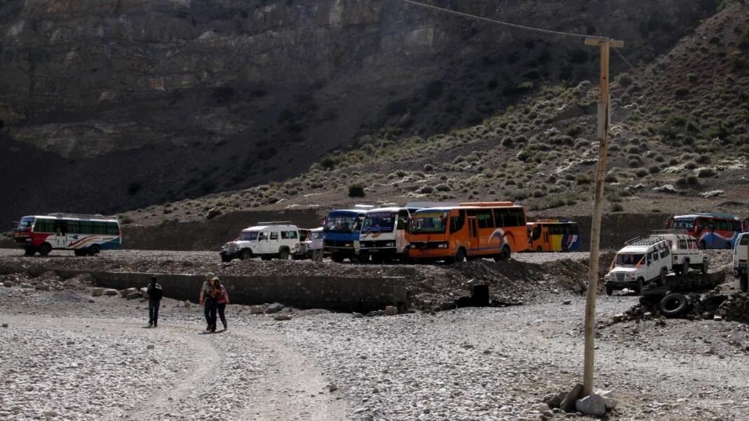
Although Jomsom is not very far from Pokhara on the map, reaching it is much more challenging than the distance suggests. The route follows the Kali Gandaki Valley through rugged mountain terrain, with steep slopes, river crossings, narrow sections, and rough road conditions in several areas. Travel times can vary significantly depending on road conditions, weather, traffic, and the season.
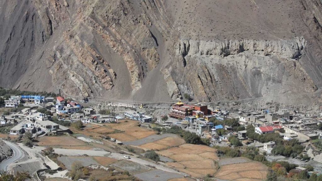
The journey takes you deep into the Annapurna and Mustang region, passing through places such as Beni, Tatopani, Ghasa, Marpha, and Tukuche before reaching Jomsom. Along the way, the landscape changes dramatically from the green hills around Pokhara to the dry, high-altitude terrain of the Kali Gandaki Valley. The route is particularly scenic, with waterfalls, cliffs, traditional villages, and views of the surrounding Himalayan peaks.
You have two main ways to travel from Pokhara to Jomsom: by road or by air. Driving is considerably cheaper and allows you to experience the changing landscapes and stop along the route, but it is a long and sometimes uncomfortable journey.
Flying is much faster and more convenient, although Jomsom flights are highly dependent on weather and are usually operated in the morning when conditions are more favorable. For trekkers heading toward places such as Muktinath, Kagbeni, or the Upper Mustang region, choosing between the two can make a significant difference to the overall journey.
Pokhara to Jomsom Distance: Quick Answer
The road distance from Pokhara to Jomsom is roughly 150 to 160 km (93 to 100 miles), although the exact distance varies depending on the route and where you measure the journey from and to. By road, the trip generally takes around 7 to 10 hours, but travel can take considerably longer when road conditions, weather, construction, or traffic cause delays.
By air, the distance is much shorter at approximately 65 to 70 km (40 to 43 miles) in a straight line. A direct flight from Pokhara to Jomsom takes only about 20 minutes under favorable conditions, making it by far the quickest way to reach the Mustang region from Pokhara. However, Jomsom flights are highly weather-dependent, and delays or cancellations are possible.
| Information | Details |
| Road Distance | Approx. 150 to 160 km (93 to 100 miles) |
| Air Distance | Approx. 65 to 70 km (40 to 43 miles) |
| Driving Time | Around 7 to 10 hours, sometimes longer |
| Flight Time | About 20 minutes |
| Main Route | Pokhara → Beni → Tatopani → Ghasa → Marpha → Jomsom |
| Starting Elevation | Pokhara: 822 m (2,697 ft) |
| Destination Elevation | Jomsom: 2,720 m (8,924 ft) |
| Fastest Transport | Flight |
| Most Flexible Transport | Private vehicle |
| Budget-Friendly Option | Road travel |
Why Are the Road and Air Distances So Different?
The difference is mainly caused by the geography of the region. The air distance measures the shortest straight-line distance between Pokhara and Jomsom, while the road has to follow the natural shape of the Kali Gandaki Valley.
The road heads north through Beni, Tatopani, Ghasa, Marpha, and Tukuche, following river valleys and winding around steep mountain terrain. It cannot travel directly from Pokhara to Jomsom, so the actual road distance is more than twice the straight-line distance.
This geography also explains why a journey of roughly 150 to 160 km can take most of a day. The route includes winding mountain roads, narrow sections, steep terrain, and stretches where road conditions can be rough. During the monsoon, heavy rainfall and landslides can create additional delays.
Flying is therefore dramatically faster, but road travel gives you a much longer look at the changing landscape from the green hills around Pokhara to the drier, high-altitude environment of the Kali Gandaki Valley and Lower Mustang.
Why Is the Road Distance Much Longer Than the Air Distance?
The difference between the air and road distances from Pokhara to Jomsom comes down to how the two distances are measured. The air distance represents a straight-line measurement between the two places, while the road distance follows a route that has to work its way through one of Nepal’s most rugged mountain landscapes.
In a straight line, Pokhara and Jomsom are relatively close. But there is no practical road that can simply travel directly north from Pokhara to Jomsom. The route has to follow the terrain, pass through river valleys, cross bridges, negotiate bends, and gradually climb toward the higher Mustang region. This makes the actual road journey substantially longer than the distance you see on a map measured from point to point.
Straight-Line Distance vs. Road Distance
Air distance, sometimes called straight-line distance, measures the shortest distance between two locations regardless of roads, rivers, valleys, or mountains in between. It is useful for understanding geographical proximity, but it does not tell you how long a road journey will be.
Road distance is different. It measures the actual route a vehicle must follow. Between Pokhara and Jomsom, that route has to adapt to the landscape rather than cut directly across it. This is why a destination can be relatively close as the crow flies but still require a much longer drive.
| Type of Distance | What It Measures | Pokhara to Jomsom |
| Air distance | Shortest straight-line distance | Approx. 65 to 70 km |
| Road distance | Actual drivable route | Approx. 150 to 160 km |
| Difference | Extra distance created by terrain and road alignment | Roughly 80 to 90 km |
Exact figures can vary depending on the starting and ending points used.
The Kali Gandaki Valley Shapes the Route
The road to Jomsom does not simply cross the mountains from Pokhara. Instead, it follows the Kali Gandaki Valley, one of the major north–south valleys cutting through the Himalayas.
From Pokhara, the journey heads toward Beni and then continues north through the valley toward Tatopani, Ghasa, Marpha, Tukuche, and Jomsom. The road generally follows the river corridor because valleys provide a more practical route through mountainous terrain than attempting to cross ridges directly.
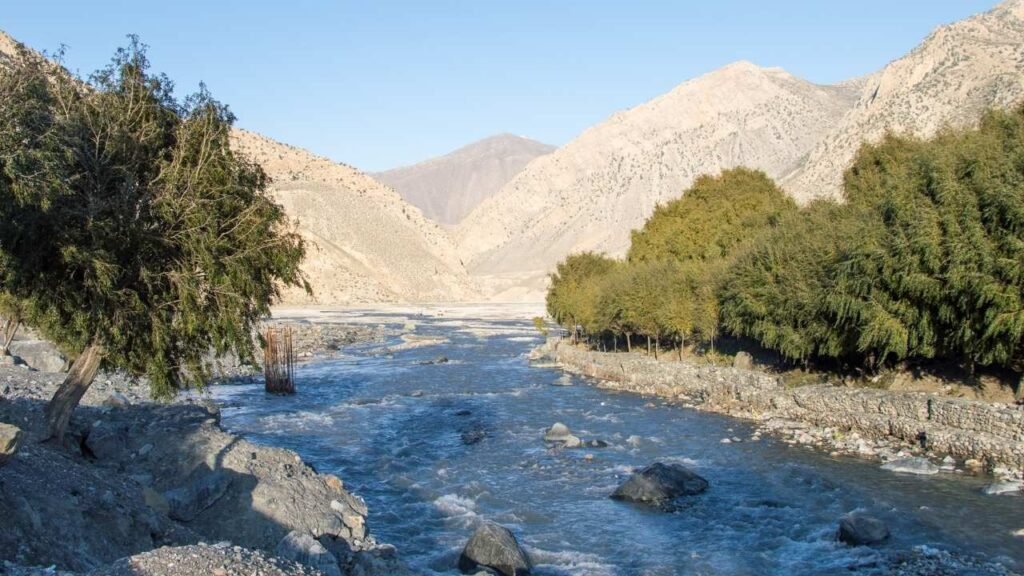
This creates a very different journey from driving across a flat plain. The road repeatedly changes direction as it follows the contours of the valley, climbs around slopes, crosses tributaries, and works its way between steep mountain walls.
Mountain Terrain Forces the Road to Wind
The biggest reason for the extra road distance is simple: mountains do not allow roads to travel in straight lines easily.
Between Pokhara and Jomsom, the landscape includes steep hillsides, deep valleys, rocky slopes, and narrow sections of terrain. A road cannot simply cut through a mountain whenever the direct route points that way. Instead, it has to find a workable gradient and avoid excessively steep sections.
That means the road may:
- Curve around mountain slopes
- Follow the bends of the Kali Gandaki and its tributaries
- Climb gradually rather than directly up steep terrain
- Cross bridges where the valley narrows or rivers intersect
- Switch direction repeatedly
- Pass through settlements that developed along the valley corridor
Every one of these adjustments adds distance compared with a straight line.
The Route Also Gains Significant Elevation
Distance is only part of the story. Elevation change is another reason the journey takes so long.
Pokhara sits at roughly 822 m (2,697 ft), while Jomsom is around 2,720 m (8,924 ft). In other words, the road climbs nearly 1,900 metres between the two destinations.
The climb is not a single steep ascent. The road gradually works its way through the Kali Gandaki Valley, with sections of climbing and descending along the route. This combination of elevation gain, winding roads, and rugged terrain naturally keeps vehicle speeds much lower than they would be on a modern highway across flat land.
Why 150 to 160 km Can Take Most of a Day?
This is why you should not judge the Pokhara–Jomsom journey purely by its kilometer count.
A journey of 150 km on a straight, modern highway could potentially take only a few hours. The Pokhara–Jomsom route is completely different. Vehicles have to deal with mountain roads, sharp bends, uneven surfaces, narrow sections, roadside activity, and changing weather conditions.
Road conditions can make the journey even slower. Heavy rain can produce mud and landslides, while loose rock and damaged sections may require drivers to slow down considerably. During the drier months, dust can also become an issue on unpaved or rough sections.
There are also frequent stops along the route for fuel, food, rest, traffic, or road conditions. As a result, a road distance of around 150–160 km can realistically consume most of a day, particularly when conditions are less than ideal.
The important takeaway is that the distance between Pokhara and Jomsom is not especially large geographically; it is the terrain between them that makes the journey long. The road has to work with the Himalayas rather than take the shortest possible path through them. That is also what makes the journey so scenic: as you travel north through the Kali Gandaki Valley, the landscape changes dramatically from the greener hills around Pokhara to the increasingly dry, rugged terrain of Mustang.
Pokhara to Jomsom Road Route
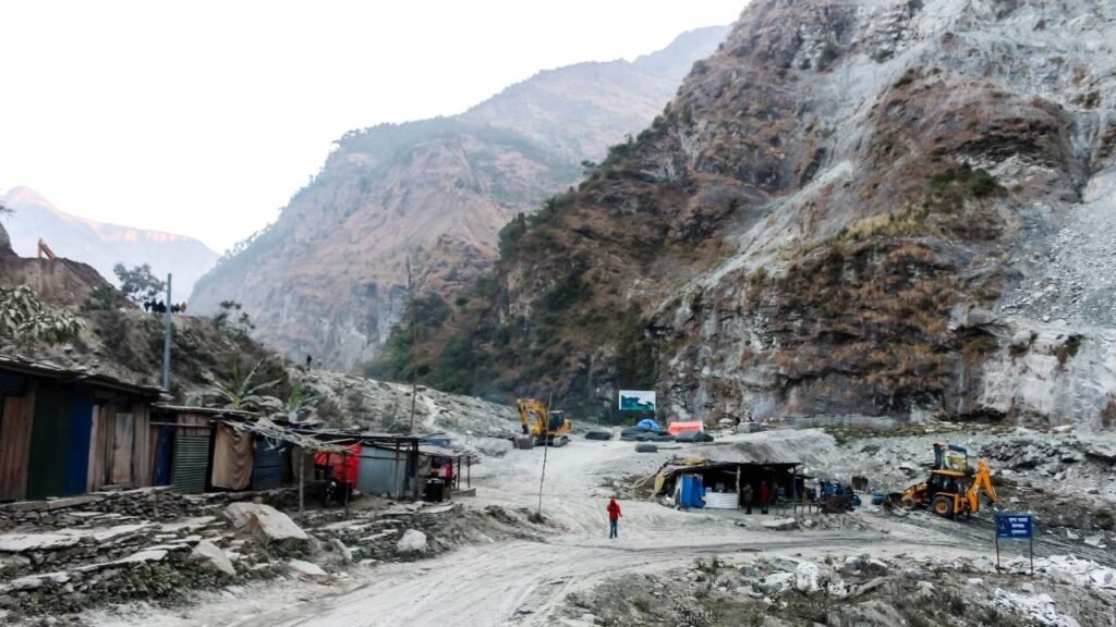
The road from Pokhara to Jomsom follows the Kali Gandaki corridor, gradually moving from the greener hills around Pokhara into the drier landscape of Lower Mustang. The commonly used route passes through Beni, Tatopani, Ghasa, Marpha, and Tukuche before reaching Jomsom.
| Place | Role on the Route |
| Pokhara | Starting point at 822 m |
| Beni | Major junction where the route turns toward Mustang |
| Tatopani | Riverside settlement known for its natural hot springs |
| Ghasa | Gateway into the deeper Kali Gandaki Valley |
| Marpha | Picturesque Thakali village famous for its stone houses and orchards |
| Tukuche | Historic settlement in the Kali Gandaki Valley |
| Jomsom | Main town and transport hub of Lower Mustang |
The scenery changes noticeably along the way. Around Pokhara and Beni, the landscape is relatively green, with farmland, forests, and rolling hills. Farther north, the valley becomes increasingly rugged and dry, with steep cliffs and barren mountain slopes becoming characteristic of the Mustang landscape.
Route: Pokhara → Beni → Tatopani → Ghasa → Marpha → Tukuche → Jomsom
What Is the Pokhara to Jomsom Road Like?
The Pokhara–Jomsom road is a mountain route rather than a smooth highway, so the journey can be considerably slower and rougher than the distance suggests. Conditions vary along the route, with paved sections mixed with gravel, uneven surfaces, narrow stretches, and areas where road maintenance or construction can affect travel.
The road follows the Kali Gandaki Valley and crosses numerous bridges and mountain sections. During dry periods, dust and loose gravel can be common, while heavy rain can create mud, erosion, and landslide problems. Some sections are particularly challenging after bad weather.
For this reason, jeeps and other higher-clearance 4WD vehicles are commonly preferred for the journey, especially when road conditions are poor or when traveling beyond Jomsom toward places such as Muktinath. Your actual travel time should always be treated as an estimate because conditions can change quickly.
Pokhara to Jomsom Road Conditions by Season
The road is not equally easy to travel throughout the year. Autumn and spring generally offer the most favorable conditions, while the monsoon presents the greatest risk of delays and disruptions.
| Season | Typical Road Conditions | Travel Consideration |
| Spring (Mar to May) | Mostly drier; conditions generally improve | Good period for road travel |
| Monsoon (Jun to Aug) | Heavy rain, mud and landslide risk | Highest chance of delays |
| Autumn (Sep to Nov) | Generally dry and stable | One of the best periods for the journey |
| Winter (Dec to Feb) | Cold, with possible snow/ice at higher elevations | Weather can affect road conditions |
The biggest point to remember is that the Pokhara–Jomsom road is highly seasonal. A journey that takes 7 to 10 hours in favorable conditions can take significantly longer when rain, landslides, road damage, or other disruptions affect the route.
Pokhara to Jomsom by Flight
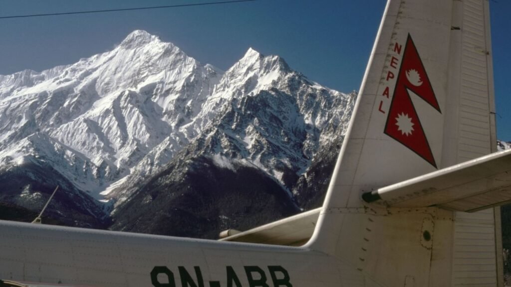
Flying is the fastest way to cover the distance between Pokhara and Jomsom. The straight-line distance is roughly 65 to 70 km (40 to 43 miles), compared with approximately 150 to 160 km (93 to 100 miles) by road. A direct flight takes only about 20 minutes, while the road journey generally takes 7 to 10 hours or more depending on conditions.
| Factor | By Road | By Flight |
| Distance | Approx. 150 to 160 km | Approx. 65 to 70 km |
| Travel Time | 7 to 10+ hours | About 20 minutes |
| Departure | Pokhara | Pokhara International Airport |
| Arrival | Jomsom | Jomsom Airport |
| Cost | Generally cheaper | Considerably more expensive |
| Weather Dependence | Moderate to high | Very high |
| Scenic Experience | Excellent | Excellent aerial views |
| Best For | Budget and scenic travel | Saving time |
The 20-minute flight time does not represent the entire journey, however. You still need to travel to Pokhara International Airport, complete check-in and security procedures, and wait for boarding. Flights are generally operated in the morning because conditions in the Kali Gandaki Valley often become less favorable later in the day.
Why Are Jomsom Flights So Weather-Dependent?
The short flight is heavily influenced by mountain weather and visibility. Jomsom sits in the Kali Gandaki Valley, where strong winds commonly develop later in the day. Cloud cover, poor visibility, and changing conditions around the mountains can also affect whether flights can operate.
This makes the flight much faster than driving but less predictable. A scheduled 20-minute flight can still involve several hours of waiting if weather delays the departure, and flights may occasionally be cancelled when conditions are unsuitable.
For travelers choosing between the two: flying can save most of a day, while traveling by road costs less and lets you experience the entire Kali Gandaki Valley. If your itinerary is tight, the flight is the obvious time-saving option; if you have time and want to experience the journey itself, the road is more rewarding.
What Is the Best Way to Travel from Pokhara to Jomsom?
The best option depends mainly on your budget, available time, and tolerance for a long mountain road journey. Flying is the clear choice if you want to reach Jomsom quickly, while traveling by road is better if you want to experience the Kali Gandaki Valley and keep transportation costs lower.
- Budget Travelers: Bus or shared jeep offers the lowest-cost way to reach Jomsom.
- Couples: A flight saves considerable time, while a private vehicle offers more flexibility and privacy.
- Families: A private jeep is generally the most practical choice, particularly with luggage.
- Trekkers With Limited Time: Flying allows you to start your trek much sooner.
- Scenic Travelers: Go by road; the changing landscape from Pokhara to Mustang is a major part of the journey.
- Groups of 4 to 7: A shared or private jeep can offer a good balance of cost, comfort, and flexibility.
In simple terms, fly if time matters most; drive if the journey itself matters most.
What Time Should You Leave Pokhara?
For a road journey, an early-morning departure is generally the better choice. Leaving early helps you get through traffic around Pokhara before it builds up and gives you more daylight for the long mountain journey. It also provides some buffer if you encounter road construction, rough sections, traffic, or unexpected delays.
Morning is particularly important for flights. Pokhara to Jomsom flights are generally scheduled early because winds in the Kali Gandaki Valley often become stronger later in the day. However, departure times and operations can change according to weather and airline schedules, so always confirm your flight before traveling.
Is the Pokhara to Jomsom Road Safe?
The Pokhara–Jomsom road requires more caution than a conventional highway, mainly because of its mountainous terrain and variable road conditions. Rough or narrow sections, landslides, heavy rain, loose gravel, and changing weather can all affect the journey.
That does not mean the road should automatically be considered dangerous. Conditions vary considerably by season and by section of the route. Traveling during daylight, choosing an experienced local driver, using a suitable vehicle such as a jeep when conditions require it, and avoiding unnecessary night travel can make the journey more manageable.
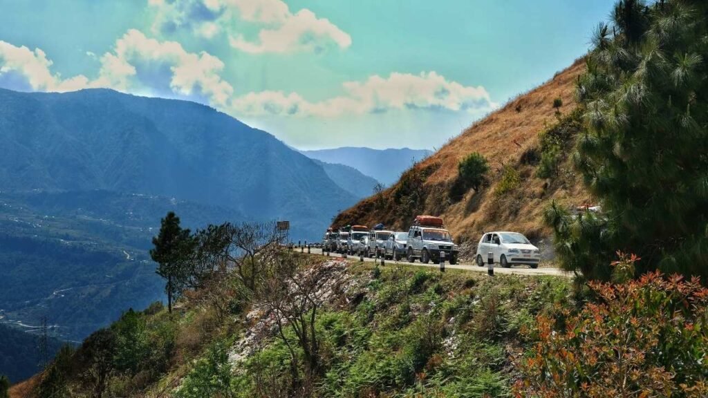
During the monsoon, it is particularly important to check current road conditions before departure, as heavy rainfall can cause temporary disruptions or landslides.
Pokhara to Jomsom is only around 150 to 160 km by road, but the Himalayan terrain makes it a full-day journey in many cases. Fly if you want speed and have a flexible schedule for weather; take the road if you have enough time and want to experience the dramatic transition from Pokhara’s green hills to the rugged landscape of Mustang.